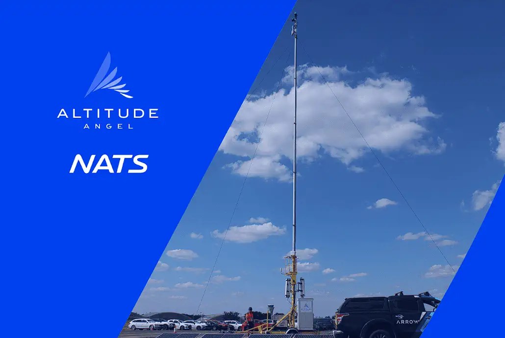
Arrow Towers deployed ‘behind the scenes’ at Farnborough Airshow to demonstrate enhanced airspace situational awareness
A new “Detect and Avoid” (DAA) platform which identifies and tracks drones and other aircraft, brought another dimension of safety and security to last week’s Farnborough International Airshow.
The Arrow ground-based DAA, deployed in partnership by NATS Services, the commercial arm of the UK’s leading air traffic services company and Altitude Angel, the world’s most trusted UTM (Unified Traffic Management) technology provider, continuously monitored the airspace, notably aircraft operating at lower levels.
Lower-level traffic can be difficult to track using traditional radar systems, and Arrow has been developed by Altitude Angel to ensure safety of all users by detecting authorised and unauthorised traffic – including drones. It is making ‘flying under the radar’ a thing of the past.
Authorities at the show had real-time access to the data gathered by the Arrow towers; NATS and Altitude Angel were able to demonstrate the capability of the technology.
Richard Ellis, NATS Head of New Airspace Users, said: “A pop up service like this one is a great example of how safety can be achieved in very complex environments where non-cooperative drone activity can have a real impact on an airshow. It’s a privilege to be able to demonstrate the capability of the Arrow technology with the authorities at a premier event such as Farnborough Airshow.”
Richard Parker, CEO of Altitude Angel, added: “Working alongside Farnborough International and NATS Services over the course of a very busy airshow is great validation of the performance – and range – of the sensor and software technologies we’ve developed. The Airshow is a very busy airspace environment, attended by crowds of hundreds of thousands; our Arrow towers, deployed in just a matter of hours, demonstrated an ability to provide vital intelligence to the authorities, a service that can help to safeguard very complex events.”
The Arrow capability, deployed in the Airshow grounds, collected data from a deployment of road-towable mast-based sensors to create a view of lower-level airspace within Farnborough Airport’s flight restricted zone (FRZ) and beyond. The infrastructure was completely self-sufficient, including generation of its own (solar) power and a private communications network, only requiring minimal space from the Airshow organisers. This picture included real-time visibility of non-electronically conspicuous aircraft and drones, those which don’t carry traditional transponders, fused into a single airspace picture.
Alex Culley, NATS GM Farnborough Airport, said: “Our focus during the airshow is to ensure a safe event for visitors and participants and minimal disruption to our neighbouring airspace users. We need a robust and comprehensive view of all traffic moving in and out of the airshow and new technology solutions can help enhance safety, security, and operational efficiency within the airspace.”
In March 2024, NATS and Altitude Angel formed a strategic partnership to enable competitive and innovative services to integrate new airspace users, while maintaining safe operations for its existing commercial aviation customers. The partnership will also accelerate the roll-out of ARROW technology, which when fused with Altitude Angel’s GuardianUTM platform, detects and identifies all airspace users, enabling drones to fly BVLOS and share the airspace with crewed aviation safely and securely.
About NATS
NATS is the UK’s principal air navigation services provider and is split into two main businesses, which provide two distinct services:
NATS (En Route) plc (NERL) — the regulated business, which provides air traffic management services to aircraft within UK airspace and over the eastern part of the North Atlantic; and
NATS (Services) Ltd (NSL) — the unregulated business, which provides air traffic control services at many of the UK’s major airports (15 civil and 7 military airfields) and other airports overseas.
NATS provides UTM, aerodrome, data, engineering, capacity, efficiency and environmental performance solutions to customers worldwide, including airports, airlines, air traffic service providers and governments.
About Altitude Angel
Altitude Angel is an award-winning provider of UTM (Unified Traffic Management) software, enabling those planning to operate, or develop, UTM/U-Space solutions to quickly integrate robust data and services with minimum effort.
Today, Altitude Angel’s market-defining technology is providing a critical, enabling service on which the future of UTM will be built across the globe. Altitude Angel has been leading a consortium of businesses to build and develop a ‘drone superhighway’ connecting airspace above Reading, Oxford, Coventry, and Rugby. The SKYWAY superhighway network, enabled using Altitude Angel’s patented Arrow® technology, will unlock the huge potential offered by unmanned aerial vehicles and be a catalyst to enable growth in the urban air mobility industry.
Altitude Angel’s first party solutions also power some of the world’s leading ANSPs, aviation authorities and Enterprises, including NATS (Services) Ltd (UK), LVNL (Netherlands) and Avinor (Norway), empowering them with new capabilities to safely manage and integrate drone traffic into national operations.
By unlocking the potential of drones and helping national aviation authorities, ANSPs, developers and enterprise organisations, Altitude Angel is establishing new services to support the growth in the drone industry.
Altitude Angel was founded by Richard Parker in 2014 and is headquartered in Reading, UK.
Altitude Angel’s developer platform is open and available to all at https://developers.altitudeangel.com
Discover more from sUAS News
Subscribe to get the latest posts sent to your email.

