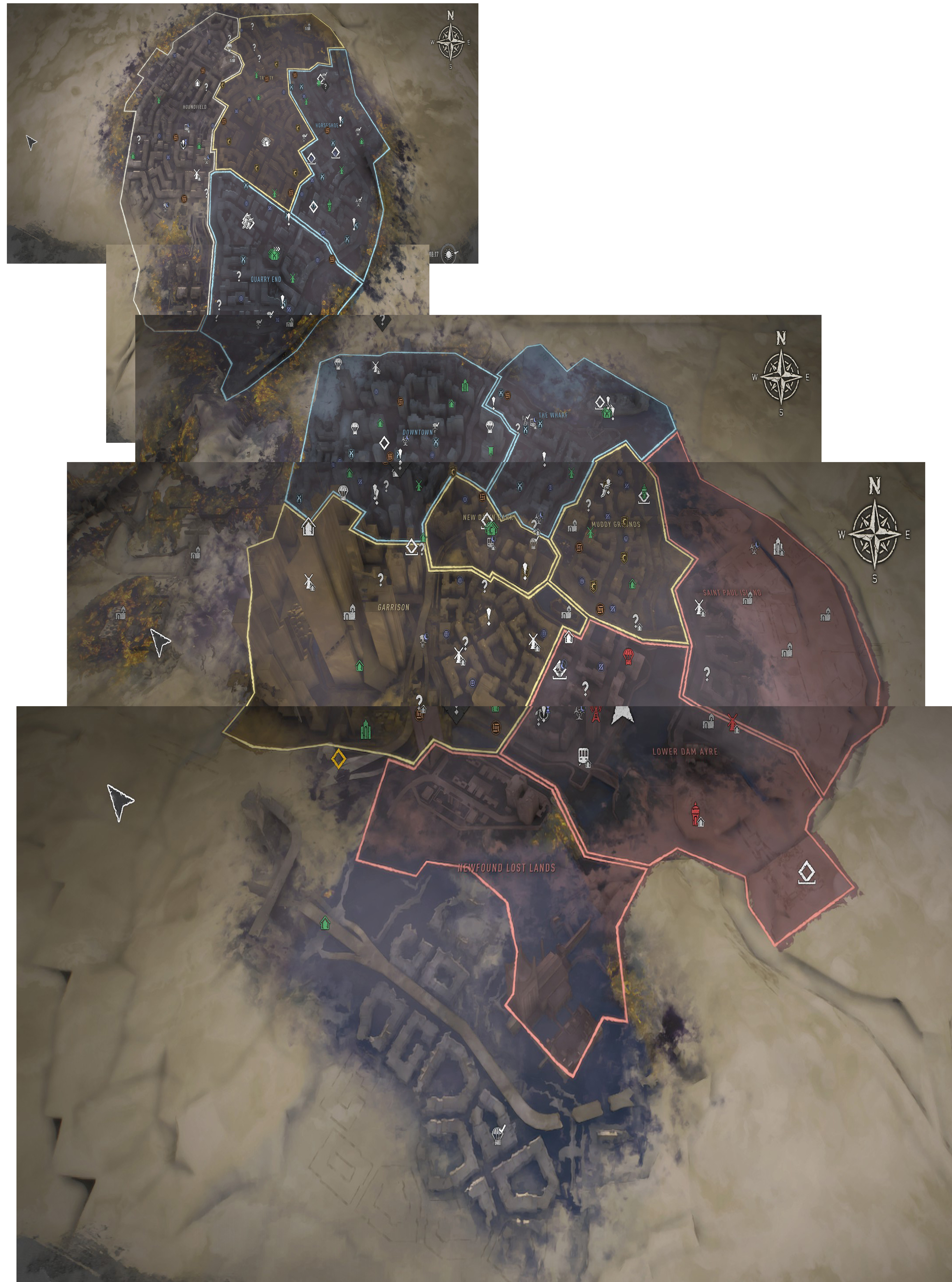
The Dying Light 2 map is big—even bigger than I thought it was when I began playing. After the tutorial takes you into the city for the first time, the map becomes available and you get a look at the first four districts within its borders. Simply running end-to-end through a single district can take a while, even with parkour helping you dodge zombies and speed across rooftops.
But that’s just the start of the open world of Villedor. There’s a whole second section of the city that’s even bigger, which only becomes accessible after completing several story missions that grant access to the tunnel that connects the two halves of the city. The two sections of the city are separated thanks to the military bombarding the area with yellow toxic sludge that quickly kills anyone who tries crossing it.
Here’s a look at the full Dying Light 2 map after 60 hours of play, and my apologies for stitching it together so crudely. It doesn’t fit on a single screen (unless you zoom all the way out, which makes it a bit useless) and it’s not a flat 2D map so it warps as you scroll it. I did my best! You can enlarge it by clicking the top right corner.

Getting around the big city takes some time, but there are fast travel options that become available as you progress. Metro stations in several districts can be cleared out to become safe zones, and once you’ve visited a metro station you can use it to sleep, store your gear, and fast-travel back to it no matter where you are on the map. There are also a couple of big settlement hubs that become available for fast-travel.
The borders you see around the edges of the city districts… well, there’s more world beyond those too, surprisingly. A few missions take you out past the city walls and toxic zones where there are some pretty sizable wilderness areas. (And even some nature-loving zombies). As you can tell by the icons scattered around on my map, there are a few areas of the city I still haven’t spent all that much time in, a bunch of quests (marked by ! icons) to pick up and unknown locations (with ? icons) to find. And past those borders to the south there’s even more to explore. Some of it is more wilderness. Some is submerged underwater. Dying Light 2’s map is genuinely huge, and seems to get bigger every time I run around near the edges of it. There’s a lot of world out there!
The size of Dying Light 2’s map might be due to Techland’s plans to add more story and paid DLC in the future. There sure seems to be enough room for it.

