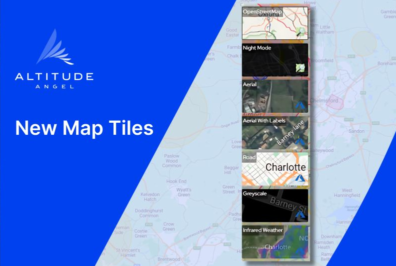
Many users may have already noticed that Altitude Angel’s drone flight planning and management solutions have now switched to Azure Maps, Microsoft’s replacement for Bing Maps. This means you will see a change in the map tiles available, which are now:➡️ Aerial➡️ Aerial with labels➡️ Road (default)➡️ Grayscale➡️ Infrared Weather (for zone managers only)The OpenStreetMap (OSM) options are still available:➡️ OpenStreetMap➡️ Night ModePlease note, Ordnance Survey maps are no longer supported in Azure Maps but we are exploring alternatives to provide terrain and elevation data.
Related
Discover more from sUAS News
Subscribe to get the latest posts sent to your email.